Map Works, Inc. Boston Shoreline.
1630
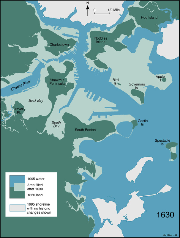
Based on historical maps and published in 1999, this map is today part of the Leventhal Map Collection at the Boston Public Library. The map is incorrect, in that the canal shown across Jeffries Point in East Boston did not exist in 1630, and it has since been corrected.
Sources
- Leventhal Map Center
- Seasholes, Nancy S.